9 November 2010 The ACT's NE Border
Map: Bungendore 1:25000
Getting There
This walk was organised and led by me as an irregular CBC Tuesday walk:
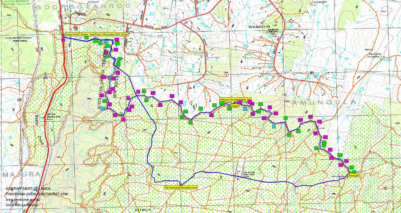
Tuesday 9 November - The ACT's NE Border- L/E,pt X. Starting at 1pm, an afternoon and into the evening stroll along the ACT's NE border on the N of Kowen Forest. All on fire trail. We should at least make Amungula trig. Around 19km and 250m climb. Map: Bungendore. Leader: John Evans - jevans@pcug.org.au, (h) 6288 7235. Transport: ~$5 per person.
4 of us met out on the Sutton Road at the border.
Further Information
Start after presentation. Sunset at 7.41pm. Moonset 10.57pm 10.8% illuminated.
Access all photographs here.
Walk
|
| Track The ACT's NE Border |
An auspicious day today, with 2 Tuesday Walks running on the same day - this, plus Max took a party to The Bog.
More success than I had expected, with a number of fine 8" pegs. We found 30 (J1, K1, L1, O1, P1, S1, T1, U1, B2, K2, L2, Q2, R2, S2, T2, V2, W2, X2, Poppet, D3, E3, J3, K3, L3, R3, S3, T3, W3, Z3, A4) border markers, a further possible 4 (M1, C2, Z2, I3) and visited an additional 38 sites where we could not identify a border marker (I1, N1, Q1, R1, V1, W1, X1, Y1, Z1, A2, D2, E2, F2, G2, H2, I2, J2, M2, N2, O2, P2, U2, Y2, A3, B3, C3, F3, G3, H3, M3, N3, O3, P3, Q3, U3, V3, X3, Y3). I forgot to take the mile markers with me.
A quick 8.7km return from Amungula Trig to the cars in 1hr 33mins, with only a slight detour along a mountain bike track as I missed a corner near the Old Homestead Recreation Area.
Thanks Mark B, Phillip S and Stephen M. Great company and great spotting.
Distance: 19.3km Climb: 400m. Time: 12.45 - 5.45pm (5hrs), with 10mins of stops.
Grading: L/E; M(8)
KMZ file for Google Earth/Maps: The ACT's NE Border
Back to Walks Index
This page last updated 23Aug22